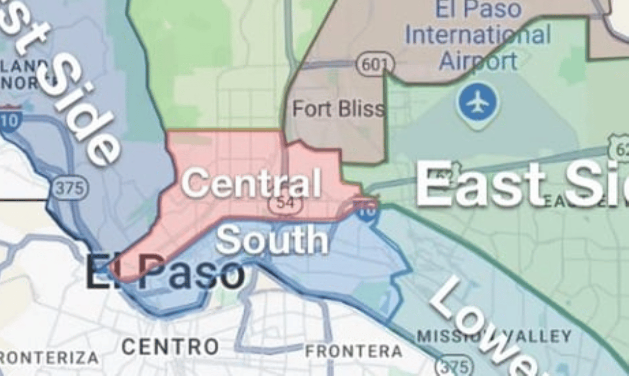
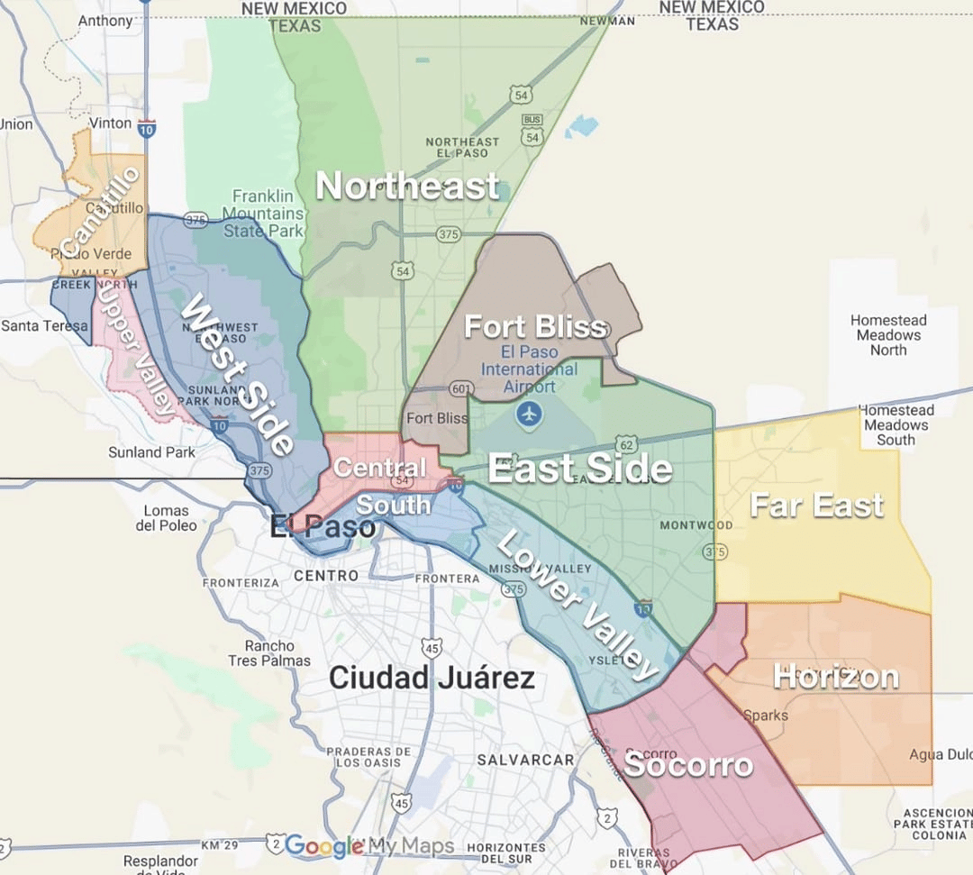
The Central El Paso area includes some of the earliest developed areas in the city and contains some of the city's oldest and most historic neighborhoods. In September 1827, Juan Maria Ponce de Leon bought 211 acres of land where El Paso and Paisano streets are today.[1] In 1849, James Wiley Magoffin purchased the lands upon which he built Magoffinsville near present-day Magoffin Avenue and Willow Street. Magoffinsville became host to Fort Bliss in January of 1854.[2] The history of this neighborhood is preserved and interpreted at the Magoffin Homestead, a public museum in the area.
Development of Central El Paso started around 1875, when the city was barely beginning to gain its roots. Today, Central El Paso has grown into the center of the city's economy and a thriving urban community. It contains numerous historic sites and landmarks. It is close to the El Paso International Airport, Downtown El Paso, the international border, and Fort Bliss.

Central El Paso is a historic and centrally located region known for its distinctive architecture, mature neighborhoods, mountain views, and convenient access to downtown and Fort Bliss.
Geography
Lifestyle
Housing
Neighborhoods
Here is a list of some of the neighborhoods in Central and South El Paso:
Schools and Convenience
Neighborhood Associations
Here is a list of some of the neighborhood associations in Central El Paso:
39,203 people live in Central El Paso, where the median age is 38 and the average individual income is $21,934. Data provided by the U.S. Census Bureau.
Total Population
Median Age
Population Density Population Density This is the number of people per square mile in a neighborhood.
Average individual Income
Central El Paso has 14,775 households, with an average household size of 2. Data provided by the U.S. Census Bureau. Here’s what the people living in Central El Paso do for work — and how long it takes them to get there. Data provided by the U.S. Census Bureau. 39,203 people call Central El Paso home. The population density is 5,903 and the largest age group is Data provided by the U.S. Census Bureau.
Total Population
Population Density Population Density This is the number of people per square mile in a neighborhood.
Median Age
Men vs Women
Population by Age Group
0-9 Years
10-17 Years
18-24 Years
25-64 Years
65-74 Years
75+ Years
Education Level
Total Households
Average Household Size
Average individual Income
Households with Children
With Children:
Without Children:
Marital Status
Blue vs White Collar Workers
Blue Collar:
White Collar:
There's plenty to do around Central El Paso, including shopping, dining, nightlife, parks, and more. Data provided by Walk Score and Yelp.
Explore popular things to do in the area, including Mapco, Roadrunner Markets, and Starbucks.
| Name | Category | Distance | Reviews |
Ratings by
Yelp
|
|---|---|---|---|---|
| Dining | 1.26 miles | 0 reviews | 0/5 stars | |
| Dining | 1.3 miles | 0 reviews | 0/5 stars | |
| Dining | 1.34 miles | 0 reviews | 0/5 stars | |
| Dining | 1.52 miles | 1 review | 3/5 stars | |
| Dining | 1.63 miles | 0 reviews | 0/5 stars | |
| Shopping | 1.39 miles | 1 review | 5/5 stars | |
| Beauty | 1.14 miles | 0 reviews | 0/5 stars | |
| Beauty | 1.17 miles | 0 reviews | 0/5 stars | |
| Beauty | 1.47 miles | 0 reviews | 0/5 stars | |
| Beauty | 1.56 miles | 0 reviews | 0/5 stars | |
| Beauty | 1.64 miles | 0 reviews | 0/5 stars | |
| Beauty | 1.64 miles | 0 reviews | 0/5 stars | |
| Beauty | 1.67 miles | 0 reviews | 0/5 stars | |
|
|
||||
|
|
||||
|
|
||||
|
|
||||
|
|
||||
|
|